When a County Line Follows the Ground
Learn how to trace a county line along a ridge or stream, uncover why it was chosen and tell a practical boundary from a natural division.
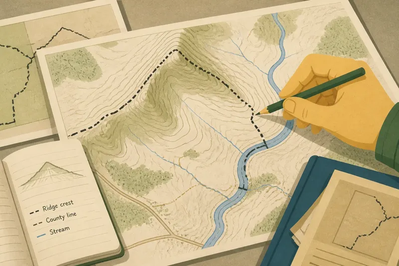
A county line that follows a ridge can look as if the landscape drew it, but the line is a human decision. To trace a county line along a ridge, stream or other feature, compare the mapped boundary with the ground, then look for the practical reasons people may have chosen that route.
The distinction matters: a feature can make a boundary easier to describe without dividing neighbouring places in any absolute sense. A ridge may be a convenient marker and still connect communities on both sides. Work through the map and its history in that order, and resist treating a tidy line as proof of a natural divide.
Start with the boundary, not the terrain
Choose a short stretch of the county line and locate it on a reliable map. An official county or local-government map can show the boundary itself; a detailed topographic map adds contours, streams and elevation. Keep the map date and source in view, because boundaries and map layers may have been revised at different times.
Mark where the line begins and ends on your chosen stretch. Then note what it appears to meet: a ridge crest, a stream, a valley floor, a road or a sequence of different features. A county boundary may follow the ground for part of its course and then leave it. The change is worth recording rather than smoothing into a single story.
For instance, imagine a reader tracing a county line across a topographic map and seeing it follow a ridge before turning towards a stream. They could mark each segment and compare it with an older county map; the observable result would be a clearer account of where the line tracks terrain and where it does not.
Check what the ground feature actually does
Use contour lines to identify a ridge: elevations form a crest with slopes falling away on either side. A stream appears as a mapped channel, while a valley may be wider than the watercourse within it. Look closely at bends and crossings. The boundary might follow the crest, stay beside a stream, or merely intersect the feature before continuing on a bearing.
That distinction helps avoid a common error. Saying a line “follows the stream” is too broad if it runs along one bank, crosses the channel, or tracks a nearby valley edge. Describe what the map supports, and use cautious wording when the map scale cannot resolve the exact alignment.
A ridge or stream can be an easy landmark to describe, especially where roads or surveyed markers are scarce. But ease of description does not make it a natural border. Landforms do not assign themselves to counties; people select, record and administer boundaries.
Look for the practical reason in the record
Once you have identified the apparent alignment, consult sources that can explain its origin. Useful places to look include county boundary descriptions, local archives, historical maps, land records and government documents about boundary changes. A library or county records office may help identify which records cover the area.
Read the wording carefully. A description that names a stream or ridge may show that the feature served as a reference point. It does not, by itself, explain why officials selected it or prove that people on either side formed separate communities. To make a historical claim, look for evidence of the decision: a boundary description, a recorded agreement or another document that addresses the line’s establishment.
Older maps can reveal whether the alignment changed or whether a feature was used as a reference before a later map was made. Compare the maps cautiously: different scales and conventions can make the same line appear to shift. Treat the map as evidence of how the boundary was represented, not automatically as a record of the decision behind it.
Separate a convenient marker from a natural division
A practical boundary often has a legible feature to follow. A ridge crest can be easier to describe than a line across an open slope; a stream can offer a recognisable reference in a landscape with few other markers. Those are possible practical reasons, not conclusions to assume without supporting records.
A natural division makes a stronger claim: that the feature separates places in a meaningful way. Ask what kind of separation is meant. A watershed may direct water to different drainage basins, but it need not separate travel, work or local ties. A stream may mark a county line while bridges, paths and shared services link the communities around it.
Use a precise description: “the boundary uses the ridge as a reference” is different from “the ridge divides the region”. The first describes a mapped relationship; the second needs evidence about how the landscape affects connections and activity.
What should you check before explaining the line?
How can you tell whether a county line follows a ridge?
Compare the boundary with the contour pattern on a topographic map and check whether it stays near the crest. If the map is too small-scale to show that clearly, describe the alignment as approximate rather than exact.
Does a stream always mark the county boundary?
No. The line may follow a section of the stream, run along one side, cross it, or only approach it. Trace the line itself instead of assuming that the nearest blue map mark defines it.
What records can explain why the line was chosen?
Start with boundary descriptions, older maps and local or county archives. A feature named in a record may explain how the line was described, while evidence of the original decision is needed to support a claim about why it was chosen.
Can a mapped feature prove that counties are naturally divided?
No. It can show that a boundary aligns with a landform or watercourse, not that the feature separates communities or regions in every meaningful sense. Make that larger claim only when you have evidence about the connections and divisions you mean.
Write a description that keeps the evidence clear
Put your findings in three parts: what the current map shows, what historical records support and what remains uncertain. For example, you might say that a county line appears to track a ridge on a topographic map, while a boundary description names that ridge as a reference. If you find no record explaining the choice, say so plainly instead of supplying a motive.
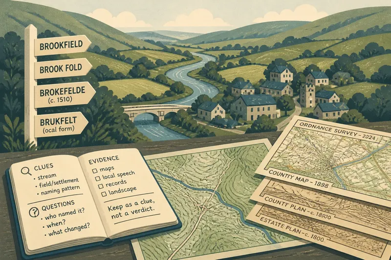
Check place names and feature labels against the map or record you cite. A ridge may have a local name that differs from the label on a modern map, and a channel can shift or be represented differently across editions. Where exact alignment affects an official or property matter, consult the relevant local authority or a qualified surveyor; a general map is not a substitute for an authoritative boundary determination.
Tracing a county line along the ground is most useful when it leaves room for both geography and history. The land may have offered a practical marker, but it did not make the political choice. Keep the distinction visible, and your account will explain what the line follows without claiming that the landscape forced it.